
Bike Routes
Bike Routes at Nassfeld.
Looking for the perfect route?
Bike Routes Nassfeld
Our favorite routes around Nassfeld, Tröpolach & Pontebba. Curated by Sölle Sport.
Three Countries. One Bike. Nassfeld is located right at the tri-border area of Austria–Italy–Slovenia: one of the most diverse bike regions in the Alps. The Giro d’Italia passes through the neighborhood, with stages to Tarvisio and up the Zoncolan. The trails range from Carinthian alpine pasture paths all the way across the Italian border to Pontebba. And after the ride? Jump into Pressegger Lake, feet in the Gail river, a boat trip on Weißensee: almost every route here ends at the water.
What follows is not a generic tour guide. It’s what we ride. What we recommend to friends. What we’ve tried ourselves with the kids and what we push to the limit on the road bike after work.
Most importantly: always start your planning with three questions.
- Starting point: Sölle Sport Tröpolach, Sölle Sport Nassfeld or Sölle Sport Pontebba (Opening July 2026)
- Which bike? MTB, E-MTB, road bike or gravel?
- With kids? And most importantly: how experienced are the kids?
Let’s go.
Start Tröpolach (614 m)
Home base with Sölle Sport Store and Bike City (Opening Summer 2026). Valley station of the Millennium Express, starting point of the Gailtal Cycle Path R3.
- © OpenStreetMap contributors
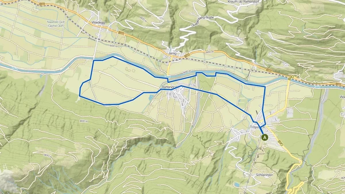
Trout Farm
For cruising and dangling your feet in the Gail
Difficulty: Easy- Distance
- 10 km
- Elevation gain
- 30 hm
- Duration
- 30 m elevation
A relaxed loop from Tröpolach to the trout farm and back. Quiet paths, minimal traffic, and the highlight: kids marveling at the trout (or eating them). The perfect "first ride" for families with young children who can't or don't want to pedal far. Along the route there are rest spots by the Gail river and the picture-perfect village of Rattendorf.
- © OpenStreetMap contributors
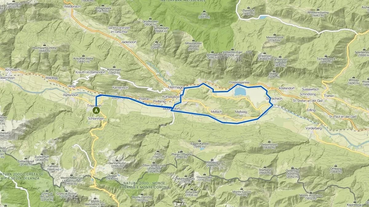
Pressegger Lake Loop (2 Variants)
The Classic
Difficulty: Easy- Distance
- 20 / 33 km
- Elevation gain
- 50 hm
- Duration
- 50 m elevation
Along the Gailtal Cycle Path R3 to Pressegger Lake and back. Almost entirely paved, practically flat, with Carinthia’s warmest swimming lake as the destination. The kids jump in, the parents have coffee. Done. For something sportier: loop around the lake and return along the Gail. Ideal for anyone who doesn’t want to ride the same path twice.
- © OpenStreetMap contributors
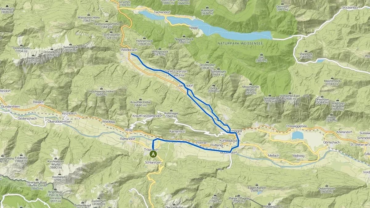
Hermagor – Weißbriach (Gössering Gorge)
The one with the jump in the stream
Difficulty: Easy–moderate- Distance
- 40 km (22 from Hermagor)
- Elevation gain
- 200 hm
- Duration
- 200 m elevation
From Tröpolach via the R3 to Hermagor and on towards Weißbriach into the Gössering Gorge. The highlight: the moment the kids drop their bikes and jump into the stream. Crystal-clear water, pools, rocks to climb. Tip: visit the Weißbriach outdoor pool or stop at Jadersdorf and walk a stretch into the Weißenbach Gorge (not for the faint-hearted: the ladders are quite something).
- © OpenStreetMap contributors
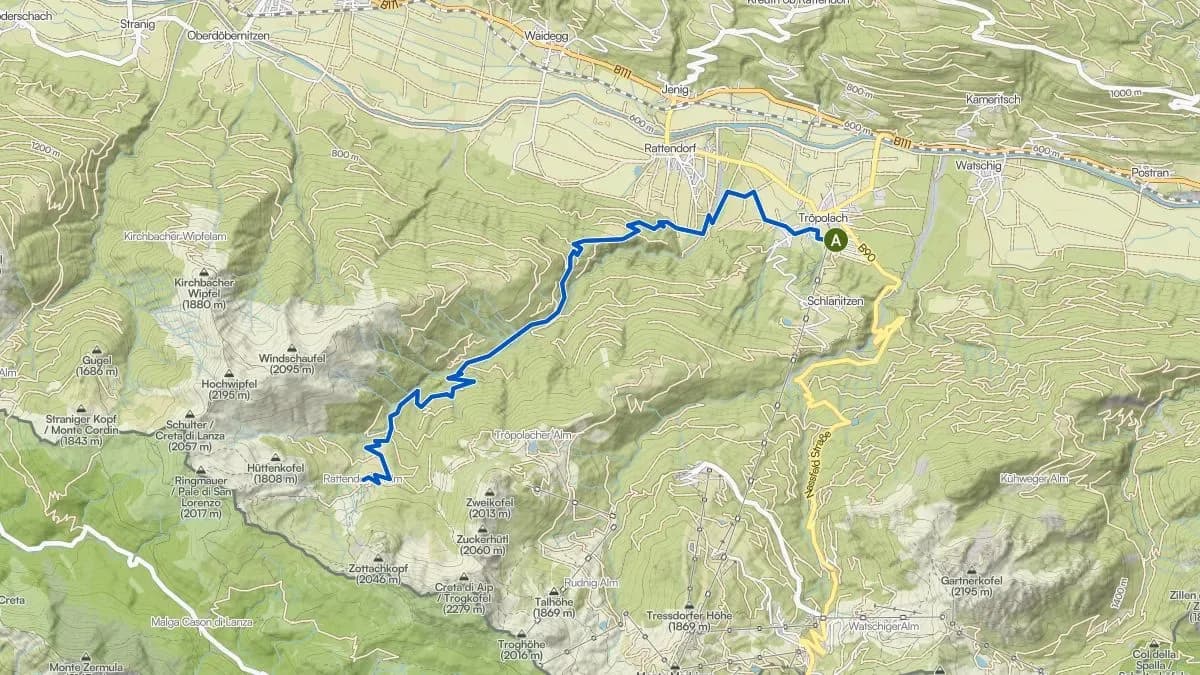
Rattendorf Alpine Pasture
When you want to go uphill
Difficulty: Moderate–difficult- Distance
- 22 km
- Elevation gain
- 920 hm
- Duration
- 920 m elevation
From Rattendorf up via gravel roads to the Rattendorf Alpine Pasture at 1,535 m. No walk in the park: it gets steep, it gets tough, and that’s exactly why the Kaiserschmarrn at the top tastes as good as it does. The hut is staffed, and the view is what brochures call “breathtaking” – and this time it’s true. Perfectly doable by e-bike, even for less fit family members.
- © OpenStreetMap contributors
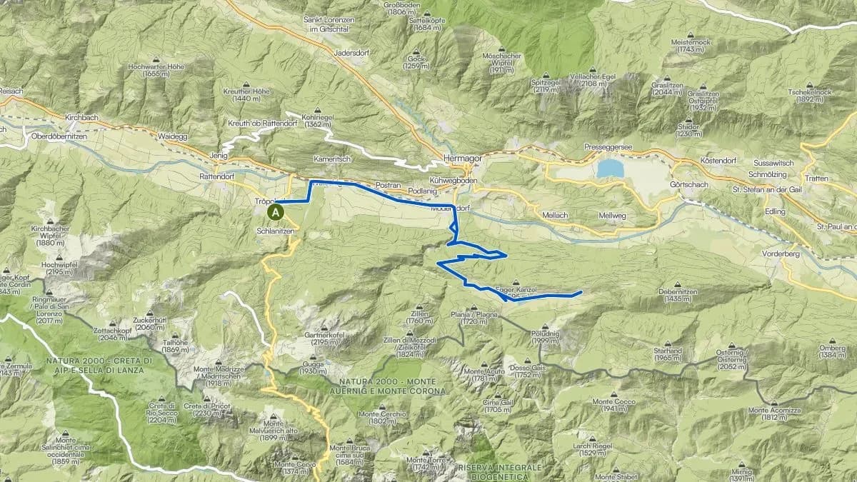
Egger Alm – Dellacher Alm
The Panorama Loop
Difficulty: Moderate- Distance
- 20 km
- Elevation gain
- 800 hm
- Duration
- 800 m elevation
From Tröpolach along the R3 to Möderndorf and up the Egger Alm road: wind your way through 14 switchbacks, then relatively flat to Dellacher Alm after the climb, and back again. Refreshment stop at both huts recommended. For those wanting more elevation: continue directly to Poludnig Alm (note: gravel, not asphalt). Tip: Dellacher also works well as a road bike destination, paved all the way to the top.
- © OpenStreetMap contributors
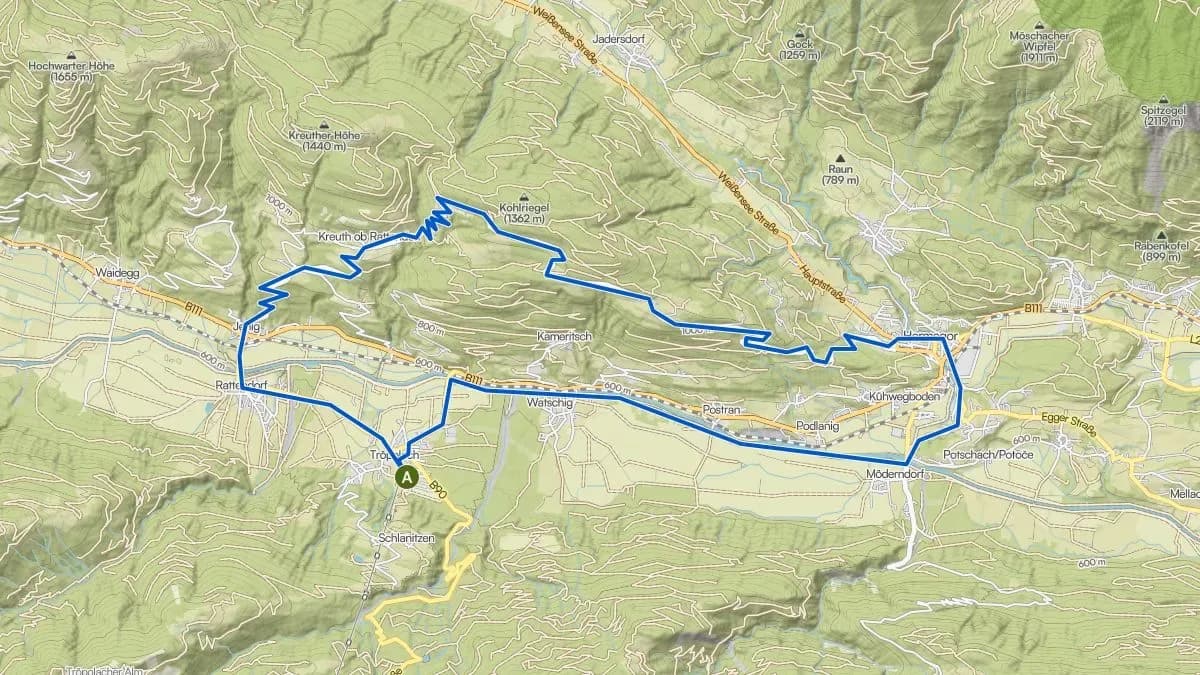
Guggenberg (HP1)
The one with the viewpoint
Difficulty: Moderate- Distance
- 30 km
- Elevation gain
- 800 hm
- Duration
- 800 m elevation
One of the most beautiful MTB loops in the Gailtal. From Tröpolach via the R3 to Hermagor, then up to Guggenberg (1,188 m) with its stunning panoramic view of the Carnic Alps. Tip: definitely stop at the top of Guggenberg. The view deserves more than a quick glance.
- ★ Our pick© OpenStreetMap contributors
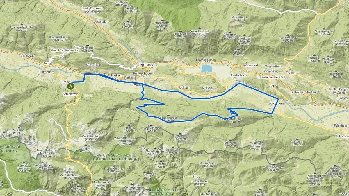
Egger Alm – Dellacher Alm – Vorderberg (HP4)
The King’s Loop of the Valley
Difficulty: Moderate–difficult- Distance
- 25.6 km
- Elevation gain
- 850 hm
- Duration
- 850 m elevation
Our personal highlight starting from Tröpolach. Up to Egger Alm, on to Dellacher Alm, then back via Vorderberg to Tröpolach. Alpine pasture landscapes, forest sections and a long, satisfying descent. This is the ride we recommend to friends who say: “I want something proper, but I don’t want to die.”
Start Nassfeld (1,530 m)
Up at the pass: less valley, more alpine pasture. The altitude gives you views right from the start. The Millennium Express takes you and your bike up top.
- © OpenStreetMap contributors
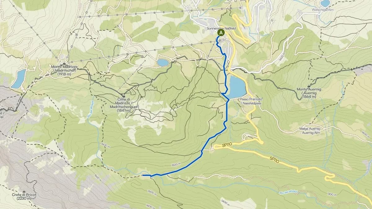
Winkelalm
The Relaxed One
Difficulty: Easy- Distance
- 6 km
- Elevation gain
- 150 hm
- Duration
- 150 m elevation
From the Nassfeld Pass to Winkelalm and back. Short, manageable, with a refreshment stop. Perfect as a beginner ride at altitude or a relaxed afternoon loop when your legs are already tired from hiking. Also suitable for hiking.
- © OpenStreetMap contributors
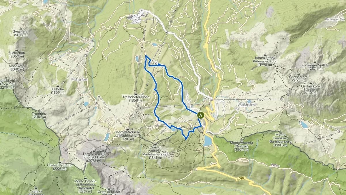
Rossalm (HP5)
The one with the show dairy
Difficulty: Easy–moderate- Distance
- 5.8 km
- Elevation gain
- 200 hm
- Duration
- 200 m elevation
From the Nassfeld Pass via the forest road towards Madritschen to Rossalm, then downhill via Tressdorfer Alm back again. At Tressdorfer Alm there is a show dairy: watch how alpine cheese is made, then taste it. Education that actually tastes good. A well-rounded morning trip, combinable with a hike or the rock labyrinth. Also ideal as a 5 km altitude training run.
- © OpenStreetMap contributors
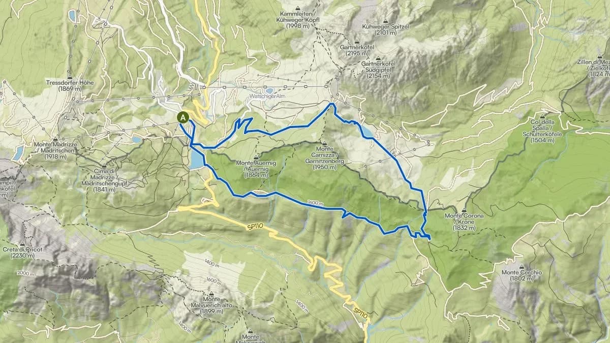
Garnitzenalm – Ofenalm (HP6)
The Border-Crosser Loop
Difficulty: Moderate- Distance
- 10.8 km
- Elevation gain
- 350 hm
- Duration
- 350 m elevation
From the Nassfeld Pass on asphalt towards Watschiger Alm, then via forest road to Garnitzenalm. From there over the saddle at the Italian border (1,675 m) and a short singletrack descent down to Ofenalm. You cross the border without really noticing: no barrier, just nature. The first four bends of the trail are demanding, then it widens out. Also suitable as a trail running loop. Various refreshment options available.
- © OpenStreetMap contributors
Nassfeld Figure-8 (HP5 + HP6)
The Figure Eight
Difficulty: Moderate- Distance
- 16 km
- Elevation gain
- 500 hm
- Duration
- 500 m elevation
HP5 Rossalm: Nassfeld Figure-8 (HP5 + HP6) (opens in a new tab)HP6 Garnitzenalm: Nassfeld Figure-8 (HP5 + HP6) (opens in a new tab)HP6 and HP5 combined into a figure-eight: the Garnitzenalm-Ofenalm loop plus the Rossalm loop. Two circuits, one starting point, maximum variety. If you already know both loops individually and want more, ride the Figure-Eight.
- © OpenStreetMap contributors
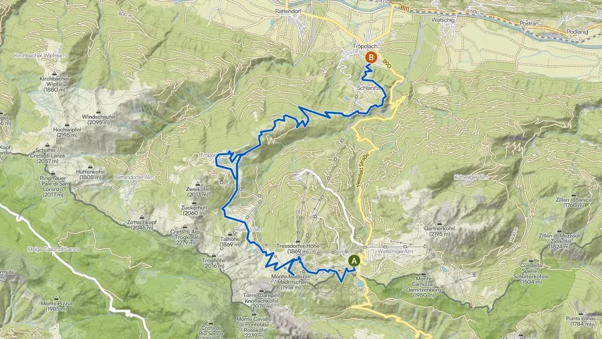
Madritschen – Tröpolacher Alm (HP7)
All downhill: the great alpine pasture traverse
Difficulty: Moderate–difficult- Distance
- 18 km
- Elevation gain
- 300↑ / 1.200↓ hm
- Duration
- 300↑ / 1,200↓ m elevation
Take the Millennium Express (bike transport available) up to Tressdorfer Alm, continue to the highest point at Madritschen, then descend via Tröpolacher Alm into the valley. The route shows the full character of the region: alpine and wide up top, forested and wild below. The descent via Rudnigalm and Tomritsch is one of the most rewarding in the area. One of the longest bike descents in the Alps: no technical demands, just the feeling that gravity is finally on your side. Tip: check the last gondola time (currently 4:30 pm).
- ★ Our pick© OpenStreetMap contributors
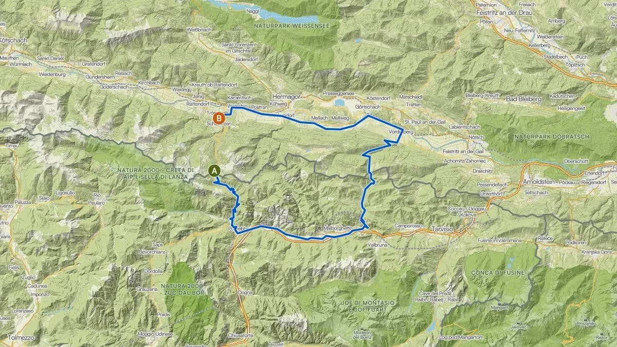
Grand Border Loop – Nordio Hut
Nassfeld – Pontebba – Nordio Hut – Vorderberg – Tröpolach
Difficulty: Difficult- Distance
- 68.4 km
- Elevation gain
- 1.090↑ / 1.990↓ hm
- Duration
- 1,090↑ / 1,990↓ m elevation
The ride worth making a special trip for. Start at the top of Nassfeld (1,530 m), via Pontebba (stop for an espresso), on to Uggovizza, up to the Nordio-Deffar Hut (refreshment stop: absolutely plan for it), through the Dolinza stream crossing, via Vorderberg back to Tröpolach. Two countries, one culinary highlight, and the feeling of having accomplished something you can’t buy. The twist: you start at the top and finish at the bottom. 1,090 m of climbing, but almost 2,000 m of descending. Gravity works with you. E-Bike tip: economy mode uphill, turbo only for the steepest sections.
Road Bike & Gravel
Longer loops without a fixed starting point. The road is calling.
- © OpenStreetMap contributors
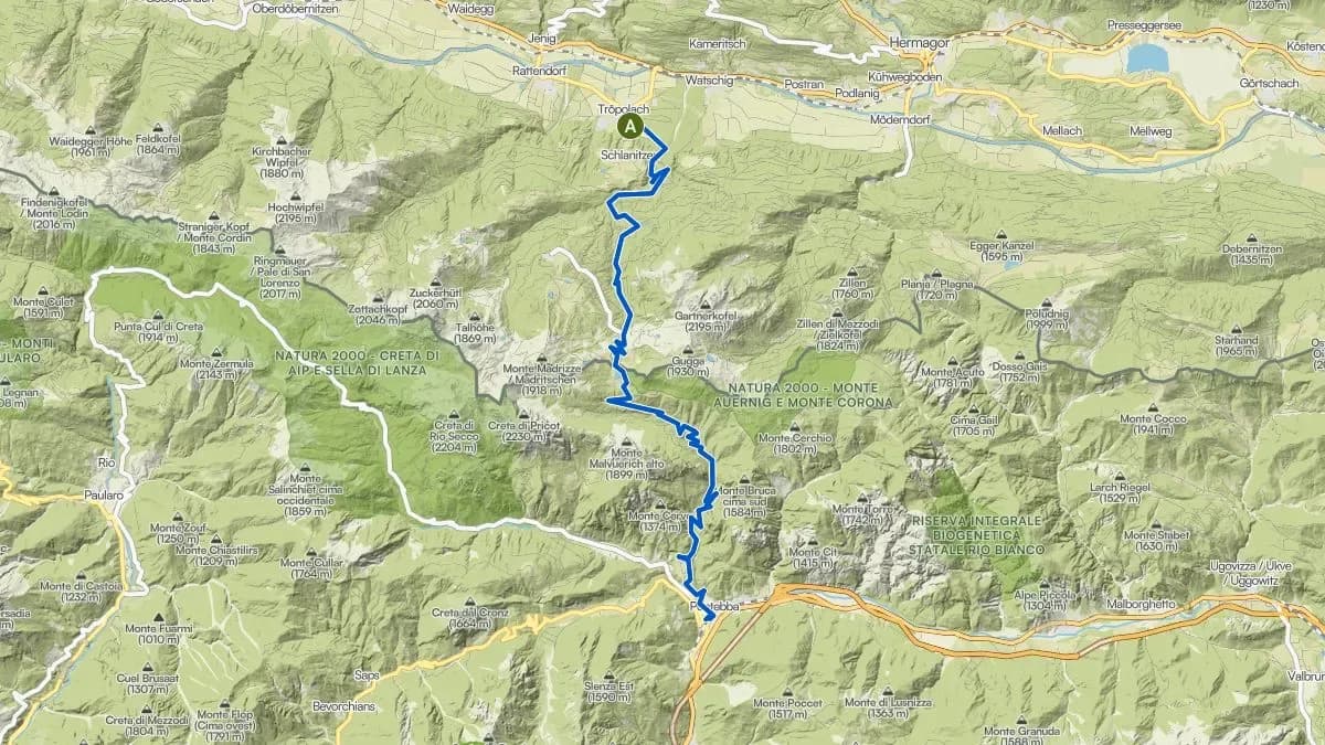
Nassfeld 2000
Tröpolach – Nassfeld Pass – Pontebba and back
Difficulty: Difficult- Distance
- 75 km
- Elevation gain
- 2.000 hm
- Duration
- 2,000 m elevation
From Tröpolach up to the Nassfeld Pass (1,530 m), down the south side to Pontebba and back. The south side (13.1 km, 970 m elevation, 7.4% average gradient) is no joke. 2,000 metres of total climbing: this isn’t a Sunday outing, it’s a statement.
- © OpenStreetMap contributors
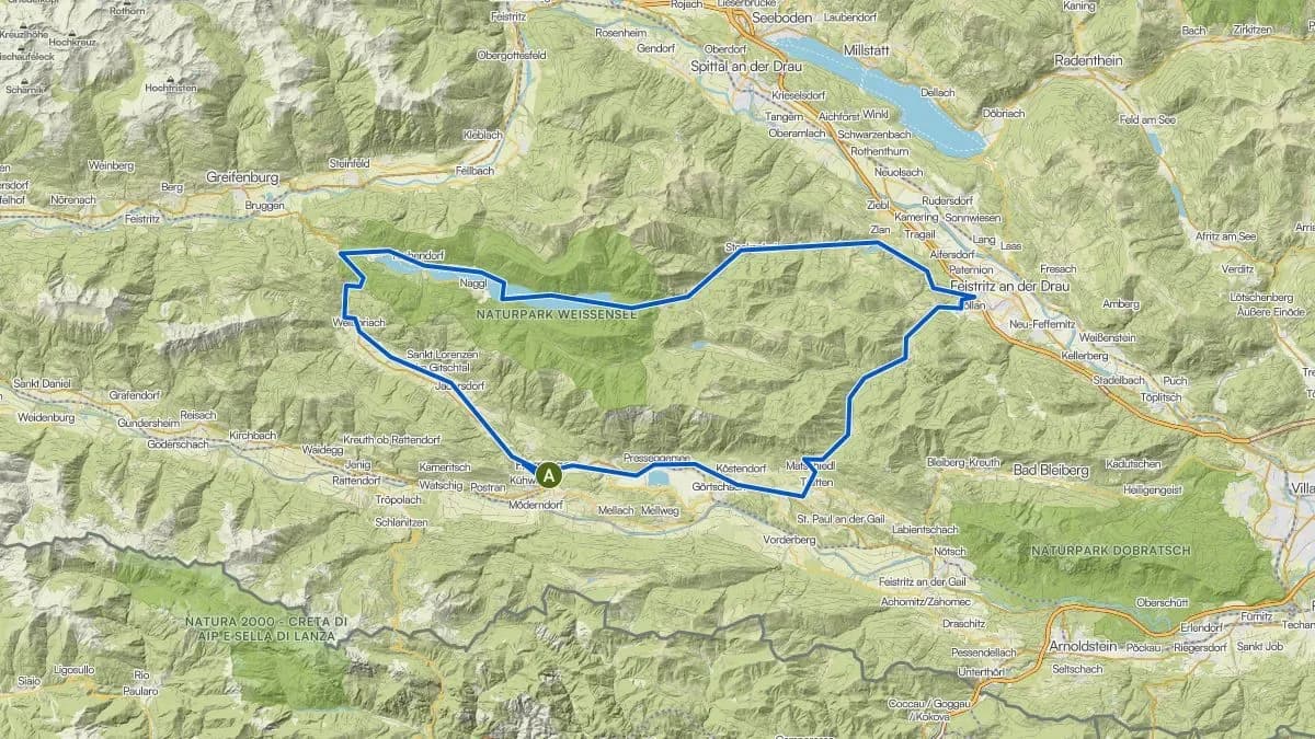
Windische Höhe – Weißensee + Boat
The Scenic Pleasure Tour
Difficulty: Moderate- Distance
- 60 km
- Elevation gain
- 1.200 hm
- Duration
- 1,200 m elevation
From Hermagor via the Windische Höhe (1,110 m) to the eastern shore of Weißensee. There: load your bike onto the boat, cross to Techendorf, then cycle back. The combination of road biking and a boat trip on the highest swimming lake in the Alps makes this route truly special. Also available as a gravel variant. Tip: check the boat schedule. And bring a camera. Seriously.
Start Pontebba (NEW from Summer 2026)
New Sölle Sport location from Summer 2026.
- © OpenStreetMap contributors
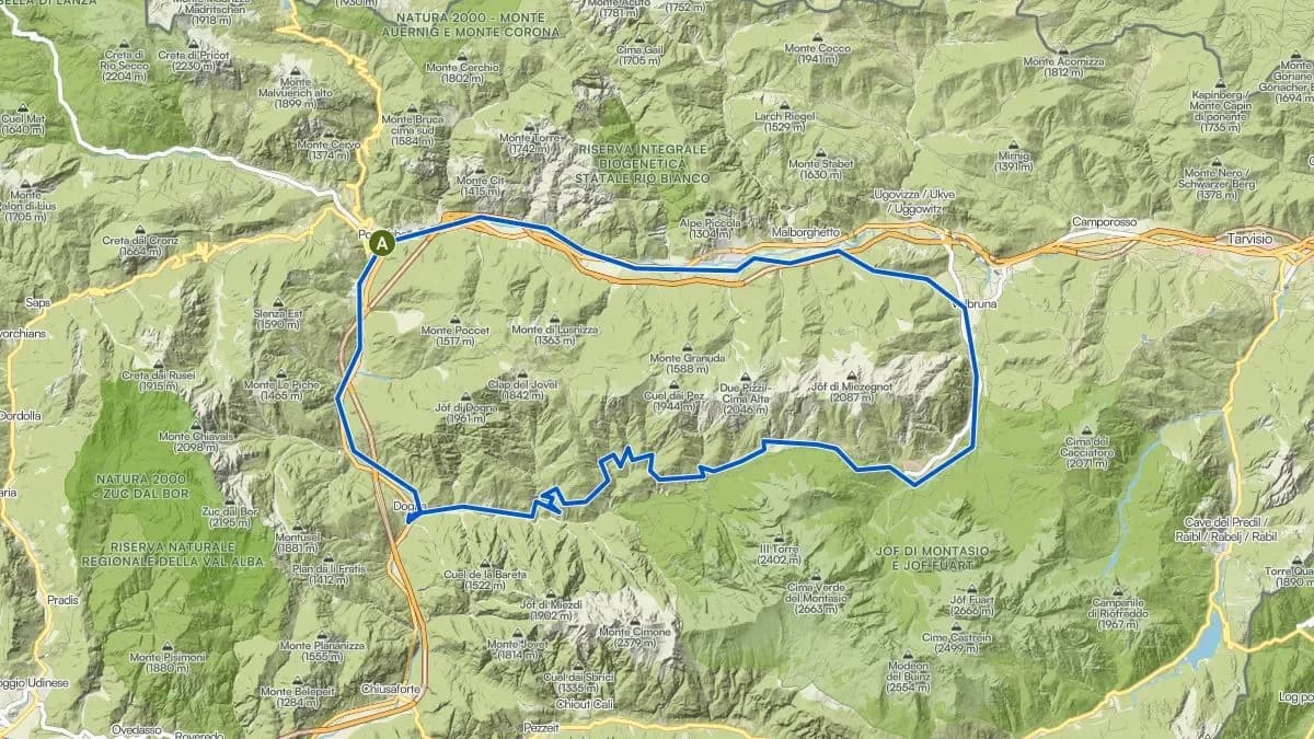
Pontebba – Spadivari
- © OpenStreetMap contributors
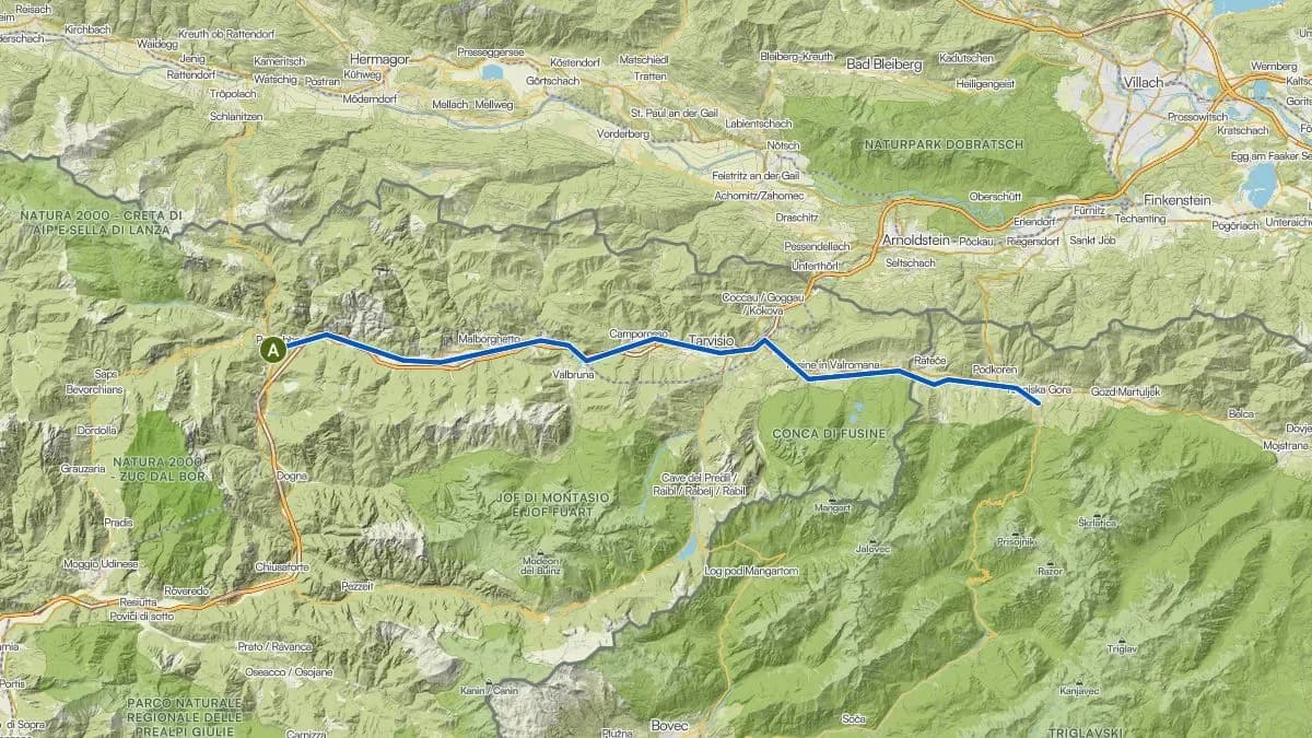
Pontebba – Venzone (or all the way to the sea)
Return by train
Difficulty: Easy–moderateFrom Pontebba heading south to Venzone. Return by train. For those wanting more: continue to Udine or, with an overnight stay, all the way to Grado on the Adriatic. All bike types suitable: road bike, MTB, e-bike.
- © OpenStreetMap contributors
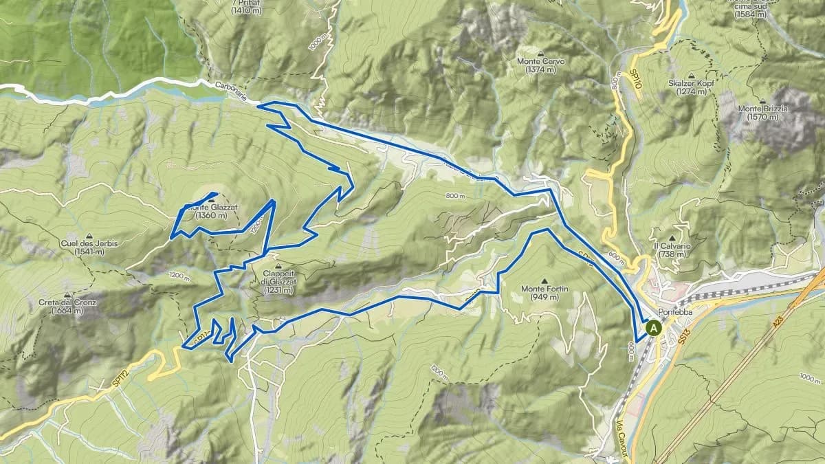
Pontebba – Malga Glazat
Mountain Bike Tour
Difficulty: Moderate- Distance
- 22.7 km
- Elevation gain
- 870 hm
- Duration
- 870 m elevation
From Pontebba up to Malga Glazat (1,350 m): an agritourism farm with homemade dairy products, open June to September. Food and overnight accommodation available. Mix of asphalt and gravel.
- © OpenStreetMap contributors
Pontebba – Kranjska Gora (or on to Bled)
Three-Country Tour towards Slovenia
Difficulty: Easy–moderate
Rent a bike locally.
Rent an e-bike or mountain bike directly from Sölle Sport – in Tröpolach or Nassfeld!
Experience the most beautiful bike tours in the Carinthian Alps with the right bike – whether it's a sporty mountain bike, a comfortable e-bike, or a children's bike: